courses
We conduct these courses in online and offline modes. For more information, contact - neha845sharma@yahoo.com

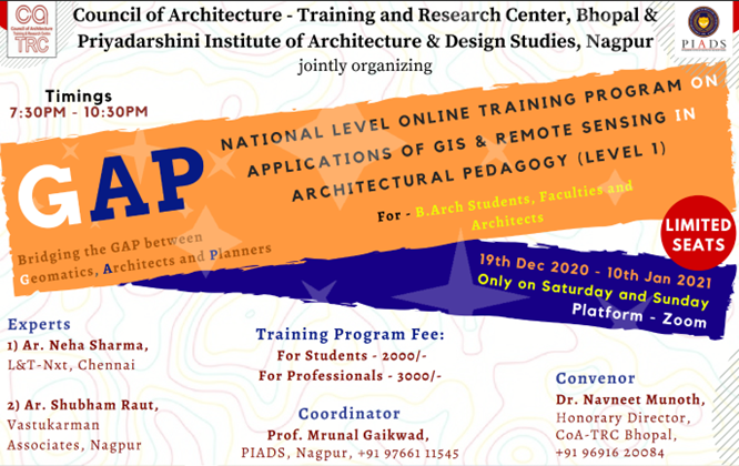
Poster of first session of our course (L1)
GAP (Bridging the GAP between Geomatics, Architects, and Planners) – Level 1
About the Course
The GAP program is a national-level online training initiative focused on the Applications of Remote Sensing and GIS in Architectural Pedagogy. Its is a 24 hours course covered in 8 days. Over 200 students and professionals have been trained through this program.
As the world progresses, Remote Sensing and GIS have become powerful, widely adopted tools across numerous disciplines — including architecture and planning. This course offers participants a foundational understanding of geospatial technologies in the context of architecture, enabling them to perform spatial analyses relevant to built environments.
Organized Sessions
- Council of Architecture - Training & Research Center, Bhopal: Training held from 3rd to 25th December 2022.
- NASA India Convention 2022: 64th Annual Convention held at Christ University, Bangalore, from 1st–3rd June 2022.
- MA-NIT Bhopal & IEEE-GRSS Gujarat Chapter: Online session conducted from 1st–30th May 2021.
- CoA-TRC Bhopal & PIADS Nagpur: Training held from 19th December 2020 – 10th January 2021.
Key Topics Covered (Level 1)
| Day | Topic |
|---|---|
| Day 1 | Introduction to GIS and Data Types |
| Day 2 | Software Installation & Coordinate Systems |
| Day 3 | Georeferencing and Digitization Techniques |
| Day 4 | Attribute Data and Spatial Queries |
| Day 5 | Geoprocessing Tools & Map Design |
| Day 6 | Introduction to Remote Sensing |
| Day 7 | Image Interpretation |
| Day 8 | Digital Elevation Models, Contours & Data Conversion |

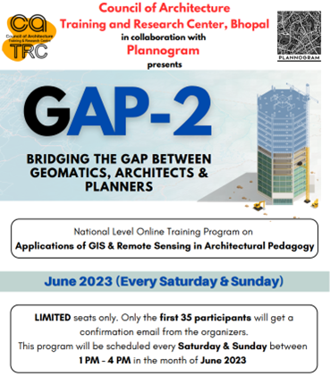
Poster of GAP L2
GAP (Bridging the GAP between Geomatics, Architects, and Planners) – Level 2
About the Course
Following the success of GAP Level 1, the Level 2 training program delves deeper into advanced geospatial applications tailored for architects and planners. The course focuses on hands-on tools and techniques such as LULC mapping, UAV-based analysis, BIM-GIS integration, and spatial machine learning — equipping participants to address complex urban and environmental challenges with geospatial intelligence.
Organized Sessions
- CoA-TRC, Bhopal & Plannogram: Training conducted from 3rd – 25th June 2023.
- CoA-TRC, Bhopal & IEEE-GRSS Gujarat Chapter: Training held from 4th – 26th June 2022.
Key Topics Covered (Level 2)
| S.No | Title |
|---|---|
| 1 | Land Use/Land Cover (LULC) Mapping |
| 2 | Change Detection Analysis of LULC |
| 3 | Digital Masterplan Preparation |
| 4 | Unsupervised Clustering for Urban Patterns |
| 5 | Building Information Modeling (BIM) and GIS Integration |
| 6 | Application of UAVs (Drone Imagery) in Urban Studies |
| 7 | Air Quality Analysis using Google Earth Engine (GEE) |
| 8 | Applications of Artificial Intelligence (AI) and Machine Learning (ML) in Spatial Data Science |