Artificial Intelligence Developer
MIT CSAIL · Remote, India
Working Group Member
WCRP Digital Twins · Global
GEOSPATIAL AI · EARTH SYSTEMS · HUMAN-CENTERED DESIGN
Reading our changing world through data, place, and AI.
I’m Neha Sharma, an Artificial Intelligence Developer at MIT and a geospatial researcher working across GeoAI, remote sensing, and scientific discovery. I help build visual data science and multimodal tools that make complex information easier to explore.
- MIT CSAILArtificial Intelligence Developer
- WCRPDigital Twins Working Group
- 200+learners and professionals mentored
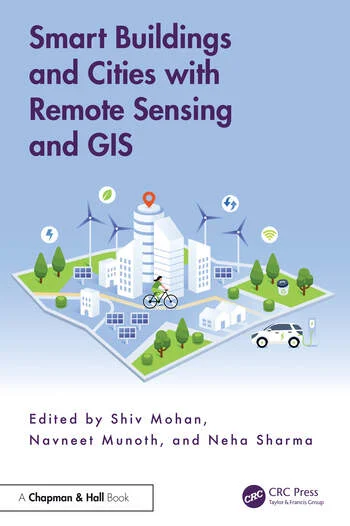
Featured book · 2025
Smart Buildings and Cities with Remote Sensing and GIS
Co-edited by Neha Sharma, Shiv Mohan, and Navneet Munoth
A cross-disciplinary guide to using remote sensing and GIS for smarter buildings and cities, from site analysis and land-use mapping to urban planning.
CRC Press · Taylor & Francis
Research & practice
At MIT CSAIL, I contribute to research and outreach for next-generation AI and scientific discovery, including a visual data science platform, multimodal knowledge exploration, and human–AI collaboration.
I’m also a member of the World Climate Research Programme’s Digital Twins – Beyond Physical Systems Working Group, part of the Digital Earths Lighthouse Activity. I collaborate on Digital Earth and Digital Twin frameworks connecting human and physical Earth systems, with applications in climate risk, water, agriculture, energy, and urban planning.
Previously, I was a Product Engineer in Geospatial Data Science at Esri’s GeoAI R&D Center in Delhi (February 2023–January 2026). Before that, I worked in GeoAI at Larsen & Toubro in Chennai, contributing to projects across the built environment.
My research interests include remote sensing, GIS, spatial data science, computer vision, and GeoAI. I have co-authored papers in international and national conferences and journals, and co-edited Smart Buildings and Cities with Remote Sensing and GIS (Taylor & Francis, 2025), connecting remote sensing with architecture and planning.
An interdisciplinary foundation
My path brings together an MS in Data Science from Liverpool John Moores University (2023), an M.Tech in Geomatics from CEPT University (2020), and a B.Arch from MANIT Bhopal (2018). I also hold a PG Diploma in Data Science from IIIT Bangalore (2021), a Google Project Management Certificate (2025), and a Certified ScrumMaster credential (2024).
Community & what’s next
Since 2020, I have co-organized and served as a subject matter expert for the Council of Architecture–Training & Research Center’s national GAP program, connecting geomatics, architecture, and planning. I also volunteer with ISG, IEEE, and CEPT University, and enjoy mentoring learners through workshops and training programs.
I also run a global geospatial group on LinkedIn—join the conversation.
Join my global geospatial group
I’m interested in collaborative research and human-centered GeoAI for urban resilience, environmental sustainability, and geospatial intelligence—turning spatial data into useful insight for the places and communities it represents.
News & updates
| Jul 30, 2026 | New publication: Satellite Image-Based Spatial Analysis of Urban Air Quality Index, published in The International Archives of the Photogrammetry, Remote Sensing and Spatial Information Sciences (2026). |
|---|---|
| Jul 07, 2025 | Started making my personal website on GitHub!   |
| May 25, 2025 | Awarded ‘Outstanding Achiever’ in MS in Data Science by Liverpool John Moores University & UpGrad. |
| Apr 02, 2025 | My first book got published - Smart Buildings and Cities with Remote Sensing and GIS! |