
Edited by: Dr. Shiv Mohan, Dr. Navneet Munoth, Ar. Neha Sharma
Edition: 1st Edition, 2025
Publisher: Taylor & Francis
Publication Location: New York
DOI: https://doi.org/10.1201/9781003453321
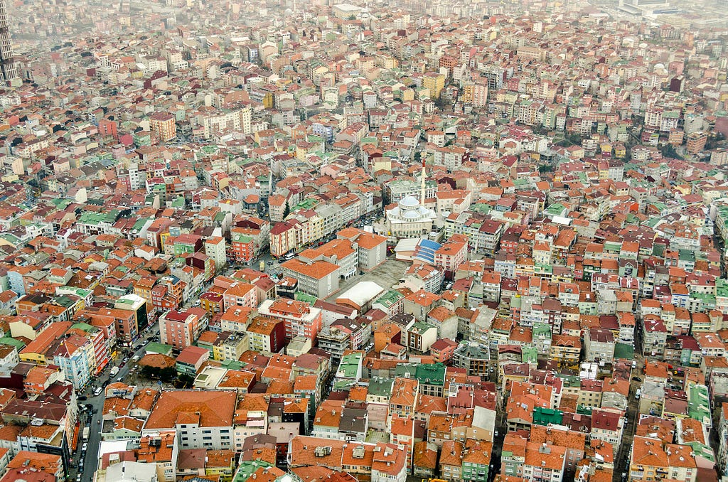
Smart Buildings and Cities with Remote Sensing and GIS explicitly integrates Architecture + Planning + Remote Sensing + GIS for creating smart buildings and cities.
Published by Taylor & Francis in 2025, this interdisciplinary book bridges a critical gap between design disciplines and geospatial technologies — a synergy that is essential for building the sustainable, smart cities of the future. 👉 The book also covers theory and practice, with contributions from academics, practitioners, and researchers across multiple countries, offering case studies, methodologies, and innovations that can be adopted globally.
👉 The book includes 28 detailed chapters, structured into three parts:
👉 Architecture and Planning education worldwide can adopt these chapters as a foundation for future curricula.
This book is designed for a wide range of professionals, researchers, educators, and students working at the intersection of design, technology, and sustainability:

✅ Architecture & Planning students (graduate, postgraduate, and doctoral levels)
✅ Faculty and educators in Architecture, Urban Planning, and Geoinformatics
✅ Urban planners, policy makers, and government decision-makers
✅ GIS, Remote Sensing, and Spatial Data Science professionals
✅ Software engineers working in GeoAI, urban analytics, and smart city platforms
✅ Sustainability leaders and climate action teams
✅ Environmental scientists and climate resilience practitioners
✅ Geographers, geomatics engineers, and urban ecologists
✅ Transport and infrastructure analysts
✅ Landscape architects, heritage conservationists, and urban designers
✅ Data scientists working with Earth Observation and spatial datasets
✅ Smart city consultants, urban innovation labs, and civic tech startups
✅ Students and researchers in interdisciplinary programs: Smart Cities, Urban Studies, Earth System Science, and Environmental Planning
If you see yourself in this list, this book was written for you.

As editors, we recognized a significant gap.
While geospatial scientists are advancing powerful tools like Remote Sensing (RS) and Geographic Information Systems (GIS), they have rarely integrated with architectural thinking, urban design processes, and community-centered planning. At the same time, Architecture and Planning professionals and students worldwide are still not being systematically trained in the use of these technologies — tools that are now indispensable for designing climate-resilient, smart, and equitable cities. This book is an attempt to bridge that divide.
It is the first global volume to explicitly integrate Architecture, Planning, and Geospatial Technologies — with practical methods, case studies, and innovations contributed by an international community of researchers and practitioners.
As the world’s cities face unprecedented pressures — rapid urbanization, climate change, resource scarcity, and social inequity — we believe that new, integrated approaches are urgently needed.
Traditionally, Architecture and Planning have relied heavily on site visits, manual surveys, and static reports. Today, with high-resolution satellite imagery, UAV data, real-time GIS, and AI-powered spatial analysis, we can:
✅ Model urban microclimates
✅ Plan for net-zero buildings
✅ Monitor heritage zones
✅ Predict urban sprawl
✅ Map urban green and blue networks
✅ Optimize public health and equity outcomes
Yet, few educational resources — and no comprehensive books globally — have brought these tools into the mainstream of Architecture and Planning education.
👉 This book fills that gap. It shows how geospatial intelligence can empower architects and planners to design the cities of tomorrow.
It offers:
✅ Concrete case studies — from net-zero buildings to heritage zones to urban sprawl prediction
✅ Actionable methods — for green space monitoring, climate-smart planning, blue-green infrastructure, and more
✅ A foundation for educational curricula — that will empower the next generation of geospatially intelligent architects and planners
As cities evolve toward smart, sustainable, resilient futures, this integration is not optional — it is essential.
We hope this volume will serve as a reference, a roadmap, and an inspiration — helping shape the practice and teaching of Architecture and Planning for those building the next generation of smarter, greener, more livable cities.
This blog post provides a detailed Chapter-by-Chapter Overview of the book — 28 global contributions on integrating Remote Sensing, GIS, and Data-Driven Design into Smart Architecture and Urban Planning with themes, authors, abstracts, and key contributions, to inspire architects, planners, geospatial professionals, and students around the world.
Authors: Jenish Patel, Neha Sharma, Shiv Mohan
Theme: Foundations | RS + GIS | Smart Cities
Tagline: The essential building blocks for geospatially intelligent cities.
👉 Summary: Introduces the fundamental concepts, components, and capabilities of Remote Sensing (RS) and Geographic Information Systems (GIS) — the two core technologies enabling smart buildings and smart cities.
Abstract: The first chapter of this book digs into the basics of geospatial technologies and explores how remote sensing (RS) and geographic information system (GIS) are transforming buildings and cities worldwide to become smarter. It gives an overview of fundamental concepts, data formats, applications in smart buildings and cities, global data portals, and widely used commercial and open-source software. From the bustling streets of Singapore to the innovative initiatives in Abu Dhabi, this chapter explores how the world’s best smart cities have used the power of these technologies in revolutionizing urban development. The chapter dives into their success stories, future trends, and government policies shaping the smart city revolution, illuminating their role in revolutionizing spatial analysis, resource management, and decision-making processes. From the vantage point of satellite imagery to the intricate mapping of urban dynamics, remote sensing offers a bird’s-eye view that unveils patterns and trends crucial for sustainable development. Complemented by GIS, which serves as the digital canvas for spatial data integration and analysis, these tools empower stakeholders to navigate complex challenges with precision and foresight. From real-time monitoring through GeoAI and big data analytics to the immersive potential of augmented reality/virtual reality and digital twins, these innovations promise to optimize resource utilization, enhance public safety, and foster inclusive urban environments. As governments globally embrace geospatial strategies, this exploration highlights how these tools not only propel technological advancement but also lay the foundation for smarter, greener, and more liveable cities of the future.
Key Contributions:
✅ Provides a clear introduction to RS + GIS fundamentals
✅ Links RS + GIS capabilities to smart city planning
✅ Equips architects, planners, and students with a geospatial foundation for future chapters
Introduction to Remote Sensing and GIS | 2 | Smart Buildings and Citie
Authors: Neha Sharma, Anandababu Devendiran, Divyeshkumar Rana, Kranthi Kiran Bandla
Theme: Satellite Data | RS + GIS
Tagline: A global guide to satellite data sources powering next-gen smart cities.
👉 Summary: Provides an in-depth overview of satellite platforms and data products available to support smart city and smart building applications, helping practitioners select the best tools for their needs.
Abstract: This chapter provides a comprehensive overview of satellite technologies and their applications in smart buildings and cities. Earth observation encompasses optical, synthetic aperture radar (SAR), hyperspectral, elevation, and environmental monitoring satellites, each offering unique capabilities. This chapter also presents key details, including launch dates, sensor specifications, spatial and spectral resolutions, data accessibility, etc. It serves as a valuable resource for architects, planners, engineers, government authorities, researchers, academicians, and professionals seeking to leverage remote-sensing data products in their projects.
Key Contributions:
✅ Comprehensive overview of relevant 100 + satellites and their data products for urban use
✅ Match satellite data characteristics with urban applications
Satellites and Their Data Products for Smart Buildings and Cities | 3
A Case Application on Shackleton Crater, Lunar South Pole
Authors: Souktik Bhattacherjee, Jayita Guha Niyogi, Debashish Das
Theme: Space Architecture | RS + GIS
Tagline: What if architects could help design habitable zones on the Moon?
🔹 Summary: Applies GIS and RS to map critical parameters for extraterrestrial habitation at Shackleton Crater — an emerging frontier for the architectural application of geospatial tools in space design.
Abstract: With increasing access to geographical and satellite data, new opportunities are emerging to integrate GIS and Remote Sensing (RS) for the analysis of extra-terrestrial environments. One of the least explored areas is using these technologies for identifying and selecting surfaces suitable for habitation beyond Earth. This study develops a framework that combines GIS and RS for evaluating habitability parameters on the lunar surface. It identifies key habitability challenges, collects relevant RS data, and applies this methodology to Shackleton Crater at the Lunar South Pole. The work highlights both computational complexities and the potential to develop algorithms that can support multi-planetary settlement planning, paving the way for future extraterrestrial architecture and site selection.
Key Contributions:
✅ Framework for GIS + RS-based extraterrestrial habitability assessment
✅ Case study of Shackleton Crater, Lunar South Pole
✅ Opens new directions for space architecture and planetary surface design
Investigating the Potential of GIS and RS Integration for Habitation o
Authors: Devansh Khare, Neha Sharma, Navneet Munoth
Theme: Architecture | Site Analysis | RS + GIS
Tagline: Transforming site analysis workflows with geospatial intelligence.
🔹 Summary: Demonstrates how GIS and RS can modernize and enhance architectural site analysis, replacing traditional manual methods with data-driven, scalable insights for smart city development.
Abstract:
This chapter highlights the benefits of incorporating emerging geospatial technologies — remote sensing and geographic information systems (GIS) for architectural site analysis. These technologies revolutionize conventional practices by reducing the need for physical site surveys while enhancing data accuracy and precision. This chapter aims to briefly introduce the conventional methods of architectural site analysis practices and highlight their enhanced GIS and remote sensing-enabled alternatives. Various crucial components of site analysis, like climate, vegetation, topography, social factors, zoning and regulation, infrastructure, and traffic data, have been demonstrated along with the data sources and their corresponding applications. The site chosen for the demonstration is in the greenfield planned city of Naya Raipur, Chhattisgarh, subtly aiming to encourage the adoption of GIS and remote sensing technologies for site analysis purposes in the upcoming smart cities, offering insights for future research and practice.
Key Contributions:
✅ Shows how to enhance architectural site analysis using GIS + RS
✅ Demonstrates workflows for climate, vegetation, zoning, and infrastructure analysis
✅ Case study application in the Naya Raipur smart city project
Smart Architectural Site Analysis with Remote Sensing and GIS | 6 | Sm
Authors: Neetu Kapoor, Vijay Kumar Bansal
Theme: Campus Planning | 3D GIS
Tagline: A 3D GIS framework for future-ready virtual campuses.
🔹 Summary: Proposes a comprehensive methodology for designing GIS-enabled virtual campuses, integrating 3D modeling, spatial databases, and interactive simulations to optimize campus planning.
Abstract: Designing virtual campuses that harness the power of the geographic information system (GIS) offers numerous opportunities for enhancing their functionality, efficiency, and sustainability. The major essence of a GIS-enabled virtual campus is a 3D virtual surface model, models of the existing buildings and amenities, interaction among the models, an information database for data exploration, and geospatial analysis. By using GIS-enabled strategies and steps, architects and planners can optimize spatial organization, transportation systems, and resource allocation, thereby creating campuses that foster innovation, sustainability, and student well-being. This chapter aims to develop a methodology for a GIS-enabled virtual campus design. The National Institute of Technology (NIT) Hamirpur is taken as a case study to demonstrate the applicability and effectiveness of the proposed GIS-enabled virtual campus design. This study involves a combination of data collection and spatial analysis for surface modeling and modeling of existing buildings and amenities. The GIS-enabled virtual campus provides a roadmap for architects and planners to transform traditional campuses into efficient, sustainable, and future-ready environments. Its implementation can result in optimized space utilization, enhanced user experiences, and increased operational effectiveness.
Key Contributions:
✅ Presents a step-by-step GIS-based virtual campus design methodology
✅ Demonstrates application at NIT Hamirpur
✅ Optimizes space, transport, and resource planning in campus design
Methodology for GIS-Enabled Virtual Campus Design | 7 | Smart Building
A Solar Energy and Sustainable Practices Approach
Authors: Amlan Saikia, Monisha Das, Mustak Ali
Theme: Net-Zero Architecture | Solar Planning | RS + GIS
Tagline: How one university is designing its path to net-zero energy.
🔹 Summary: Explores the solar energy potential and sustainable practices that can help Gauhati University achieve net-zero energy status, using advanced GIS + RS-based solar modeling.
Abstract:
The increasing dependency on fossil fuels has led to a surge in carbon emissions, prompting an urgent global need to reduce carbon footprints. This imperative extends from nations to smaller units like university campuses. This study explores the potential of university campuses, exemplified by Gauhati University, in achieving net-zero energy status. By investing in clean energy and adopting sustainable practices, campuses can curtail energy consumption, thereby minimizing their carbon footprint. Solar energy is emerging as a pivotal player in this endeavor. This study delves into the feasibility of net-zero buildings at Gauhati University, integrating remote sensing and GIS methodologies. Through high-resolution drone survey data, building footprints are extracted, forming the foundation for solar radiation modeling. The innovation lies in the intricate modeling of three types of solar radiation on a semi-hourly basis, considering local weather influences. This unexplored approach presents a novel contribution toward sustainable energy solutions at an institutional level.
Key Contributions:
✅ GIS + RS-based solar modeling for net-zero energy planning
✅ Detailed solar radiation analysis for the Gauhati University campus
✅ Scalable methodology for other academic and institutional campuses
Feasibility of Achieving Net-Zero Energy Status at Gauhati University
A Case of Garli and Pragpur, Himachal Pradesh
Authors: Preeti Nair, Swati Punyal
Theme: Heritage Preservation | Village Planning | GIS
Tagline: Bringing India’s village heritage into modern planning frameworks.
🔹 Summary: Uses field surveys and GIS mapping to assess the challenges and gaps in preserving the heritage character of villages — with case studies from Garli and Pragpur.
Abstract: This chapter focuses on highlighting the importance of heritage characteristics in the Indian village sector. It emphasizes the importance of maintaining the original fabric of villages and introducing them to the mainframe of policymaking. The primary data were collected via a field study conducted in two villages, Pragpur and Garli, with prominent heritage characteristics in the state of Himachal Pradesh. A mixed method of analysis was used along with the geographic information system (GIS) as a documenting tool. A detailed questionnaire survey was conducted to analyze the perceptions of the residents of the villages toward preserving their residential buildings in their original architectural characteristics. The survey also pondered the perceptions of the residents and their readiness for the current situation of their heritage-based village. Rural settlements have lots of architectural characteristics that need documentation and conservation and are currently neglected. Residential buildings are private property, and their maintenance is as per the owner’s wishes. These residences have changed their character and construction pattern as per the new materials available in the market. But during this process, they have lost their individuality. Therefore, the chapter evaluates the findings about the present policy framework for understanding and managing the heritage villages to establish a sustainable community. The study has identified limitations such as low-quality conservation and preservation works and a lack of incentives provided from the viewpoints of the residents of the villages.
Key Contributions:
✅ Field-based analysis of heritage conservation challenges in Indian villages
✅ Demonstrates GIS as a tool for documenting and managing heritage
✅ Highlights policy gaps and community perspectives on village heritage
Identifying the Gaps in Sustaining the Heritage Character of Villages
Authors: Ar. Vedangi Deshpande, Devyani Gangopadhyay
Theme: Cultural Heritage | Urban Planning | GIS
Tagline: Mapping the invisible: spatializing cultural practices alongside heritage assets.
🔹 Summary: Uses GIS-based spatial analysis to map the complex relationship between tangible heritage (built structures) and intangible heritage (cultural practices), demonstrated in the historic city of Nashik.
Abstract:
A geographical information system (GIS) has been actively instrumental in managing and analyzing the information and datasets in the processes of research, planning, and management across various disciplines such as geography, urban planning, and environmental studies. This chapter addresses the knowledge gap by leveraging GIS to examine the intricate interplay between urban heritage and intangible cultural practices in an urban setting. It aims to visualize the association between tangible and intangible values, analyze the spatial distribution of heritage assets, and find spatial dependencies and integration patterns. It contributes to the identification and recognition of the intangible practices associated with cultural mapping by considering the case of the historic city of Nashik. It has been observed that the conservation of tangible and intangible cultural heritage positively influences each other.
Key Contributions:
✅ GIS-based framework for integrating tangible + intangible heritage mapping
✅ Case study of Nashik — mapping the relationship between built form and cultural practices
✅ Supports holistic, inclusive urban heritage planning
Application of Geographic Information System (GIS) to Investigate the
Authors: Akshay Kaleshwarwar, Sarika Bahadure
Theme: Renewable Energy Planning | RS + GIS
Tagline: Mapping solar potential for sustainable energy transitions.
👉 Summary: Uses GIS and Remote Sensing to map solar resource suitability across the Vidarbha region, helping identify optimal sites for solar power development.
Abstract:
The geographical distribution of solar irradiance on the Earth’s surface is not uniform. Utilizing solar energy might be a possible method to meet the need for power knowing the geographic and topographical constraints. The identification of suitable land for zoning of solar energy development ensures the energy production locally for sustainable future. This study uses a geographic information system (GIS) analysis to examine the spatial suitability of land parcels for solar plants from regional perspectives. The study is conducted for the Vidarbha region in central India, which consists of two divisions: (i) Amravati division (5 districts; 56 talukas) and (ii) Nagpur division (6 districts; 64 talukas). It investigates physical solar availability using meteorological and geographical determinants to identify highly effective strategic locations that are suitable for establishment of solar power plants. Statistical analytic modeling and overlay analysis are coupled with the remote sensing database from multiple sources (USGS Earth Explorer, Solar Atlas, Sentinel-2, etc.). The process in this study is a useful tool for analyzing and visualizing the potential of solar energy and will assist decision-makers, developers, investors, and other stakeholders with specialized planning approaches.
Key Contributions:
✅ GIS-based solar suitability framework for Vidarbha region
✅ Integrates multiple remote sensing data sources
✅ Supports practical solar energy zoning and investment decisions
Solar Resource Development Suitability Analysis Using Remote Sensing a
Authors: Vidit Kundu, Sabyasachi Purkayastha
Theme: Urban Economics | Transport Networks | GIS
Tagline: How spatial networks shape commercial vitality in Indian cities.
👉 Summary: Analyzes how street network structure influences retail footfall and success in Chennai, Hyderabad, and Bengaluru, using OpenStreetMap data and sales data from a QSR chain.
Abstract: In the orbit of retail strategy, identifying the underlying factors that contribute to the success of retail clusters in the urban world is significant for increased growth and profits. Existing research highlights the significance of street network configuration in shaping vibrant retail centres; however, a comparative analysis of cities within the Indian context is notably absent. Furthermore, previous studies predominantly assessed the success of retail centres based on factors such as the number or density of establishments, with limited utilization of in-store footfall data. To address these research gaps, the study compares and provides an analysis of three major Indian cities: Chennai, Hyderabad, and Bengaluru. The methodology leverages a unique dataset encompassing sales data from a prominent quick-service restaurant chain in 2021, in conjunction with street network data derived from OpenStreetMap (OSM). The choice or betweenness centrality measure correlates well with in-store footfall, contingent upon the spatial foreground and background structure of a city.
Key Contributions:
✅ Spatial network analysis of retail success in three major Indian cities
✅ Links network centrality to in-store footfall using real-world sales data
✅ Provides insights for retail location strategy and urban transport planning
Examining the Impact of Street Network on Retail Success | 13 | Insigh
Authors: Ademola M. Adeyemi, Adebayo O. Eludoyin, Ayobami T. Salami
Theme: Land Use Change | Urban Growth | GIS
Tagline: Urban growth and its environmental impacts in Southwest Nigeria.
👉 Summary: Uses Landsat imagery, field surveys, and community interviews to map and analyze urban land cover change and its impacts in Southwest Nigeria.
Abstract: Optical or passive remote-sensing data are more available and accessible than microwave or active data and have been extensively discussed for their capacity to complementarily mix with other data sources for environmental change evaluation. The specific objectives of this study were to assess changes in land surfaces vis-à-vis urban growth and residents’ perception of the impact of the change on their lives. Data were gathered from multi-date optical remote-sensing records of Land satellite (Landsat) imagery, field surveys, and responses of key informants. Results showed an over 40% irregular increase in impervious surfaces and a significant reduction in vegetated areas and waterbodies. Over 70% of respondents changed their livelihoods from agrarian-based to rendering services during the period, while about 60% decried the loss of economic source to urbanization. The study concluded that GIS enables a complementary approach to providing decision-support information on environmental planning issues.
Key Contributions:
✅ Maps and quantifies urban land cover change in Southwest Nigeria
✅ Links impervious surface growth to livelihood changes and environmental impacts
✅ Demonstrates a community-centered approach to land change analysis
Land Cover Change Detection and Predictive Analysis of Associated Arti
Authors: Anusha Roy, Vasu Sathyakumar, Eswar Rajasekaran
Theme: Urban Climate | Justice | RS + GIS
Tagline: Mapping climate inequities through Surface Urban Heat Island analysis.
👉 Summary: Uses Landsat imagery and Google Earth Engine to analyze how Surface Urban Heat Island (SUHI) intensity varies across socio-economic neighbourhoods in Mumbai, raising critical climate justice concerns.
Abstract: Increased urbanization has led to the surface urban heat island (SUHI) effect, primarily driven by land-use changes. Particularly, in the Global South, combating the impact of SUHI is complex due to rapid urban expansion and limited planning resources. Socio-economic inequalities in these regions can exacerbate the impact of SUHI, raising climate justice concerns. This study examines the SUHI intensity across the socio-economically diverse neighbourhoods of Mumbai city in India, during three decades, 1991–2001, 2001–2011 and 2011–2021, with Landsat satellite images using Google Earth Engine. Higher socio-economic neighbourhoods exhibited lower SUHI intensity and vice versa, indicating the need for cooling strategies that prioritize equitable urban heat effect mitigation for a sustainable and inclusive urban environment.
Key Contributions:
✅ Long-term SUHI intensity analysis for Mumbai (1991–2021)
✅ Correlates heat stress with socio-economic vulnerability
✅ Informs climate justice strategies for Indian megacities
Assessing the Impact of Surface Urban Heat Island on Urban Neighbourho
Authors: Harshit Srivastava, Nitika Bhakuni
Theme: Transport Safety | Spatial Analysis | GIS
Tagline: Which spatial methods work best for road safety planning?
👉 Summary: Compares leading spatial methods for analyzing road traffic crash hotspots, including KDE, Network KDE, Nearest Neighbor Hierarchical Clustering, and Gi*.
Abstract: Road traffic crashes result in around 1.35 million fatalities annually (Aqüicultura et al. 2018). Understanding road crash data is imperative in formulating strategies and interventions for reducing the same. This chapter explores hotspot analysis techniques to decipher the most accurate method and efficient framework that can be used based on data availability. Spatial methods like Kernel Density Estimation (KDE), Network Kernel Density Estimation (NKDE), and Nearest Neighbors Hierarchical Clustering (NNH) are used. Further, to validate the outcomes of spatial analysis, statistical methods such as Gi* Statistic and Prediction Accuracy Index (PAI) are explored to decipher the most suitable technique.
Key Contributions:
✅ Systematic comparison of road crash hotspot analysis methods
✅ Practical recommendations for urban road safety planning
✅ Supports data-driven design of safer street networks
A Comparative Assessment of Methods for Identification of Road Traffic
Authors: Devyani Gangopadhyay, S.P. Sekar
Theme: Transit-Oriented Development (TOD) | Urban Planning | GIS
Tagline: Evaluating TOD potential around Chennai Metro corridors.
👉 Summary: Uses GIS tools to evaluate how urban development patterns interact with rail transit corridors in Chennai, helping guide future Transit-Oriented Development (TOD) strategies.
Abstract:
Urban areas all over the globe are confronting the challenge of ever-increasing density of population, leading to several challenges like traffic congestion, air pollution, and increased travel time for the inhabitants, resulting in a poor quality of life in cities. In order to address this issue, many countries including India are incorporating the mass rail transit system. As the mass transit system is introduced in the urban areas, it is crucial to plan an integrated land use and transportation system in order to build a desirable urban form of the city. However, this is challenging especially in cities that are already developed, and the transit is a subsequent consideration. In such circumstances, it is important to make strategic plans and decisions to bring about sustainable urban development. In this context, this chapter analyzes the case of Chennai, India, to study the pattern of development along the existing rail transit system and assess the possibilities of an integrated approach toward land use and transportation along the newly introduced metro rail transit system. QGIS is used as an efficient tool to map the development pattern of the city and devise policies and regulations for a transit-oriented development for urban areas.
Key Contributions:
✅ GIS-based mapping of development patterns along Chennai Metro corridors
✅ Identifies opportunities and barriers for TOD implementation
✅ Provides recommendations for integrated land use–transport planning
A GIS-Based Evaluation of the Urban Rail Transit Corridors' Land Use a
Authors: Neha Sharma, Piyush S. Girgaonkar
Theme: Hyperspectral Remote Sensing | Urban Mapping | RS + GIS
Tagline: Using AVIRIS data for detailed urban land cover classification.
👉 Summary: Applies AVIRIS hyperspectral imagery and advanced classification methods to generate a detailed Land Use Land Cover (LULC) map of San Diego — demonstrating the power of hyperspectral data for urban analysis.
Abstract:
Land features mapping is crucial for understanding the structure, geography, and interactions of city features, especially amid rapid urbanization. Hyperspectral remote sensing, with its detailed spectral resolution, offers significant advantages over multispectral imagery for urban analysis. This chapter reviews hyperspectral data in urban environments, focusing on its ability to map complex land cover and detect subtle material changes. Using AVIRIS data for San Diego, the methodology involves preprocessing with FLAASH for atmospheric correction and applying adaptive filters to enhance image quality. Urban features are identified and classified using spectral angle mapper (SAM) and support vector machine (SVM) methods, with accuracy assessments highlighting improvements from filtering. The results demonstrate hyperspectral imaging’s potential in detailed urban mapping, essential for efficient city management, environmental monitoring, and smart city initiatives. The study underscores the need for integrating spectral and spatial information in processing complex urban images for precise, actionable insights.
Key Contributions:
✅ Demonstrates use of hyperspectral data for urban LULC mapping
✅ Combines SAM and SVM methods for high-accuracy classification
✅ Supports more precise urban planning and smart city management
Land Use Land Cover Mapping of San Diego Using AVIRIS Hyperspectral Im
Authors: B.N. Suraksha, Sarika Bahadure
Theme: Urban Green Infrastructure | Pollution Mitigation | RS + GIS
Tagline: Can urban greenery mitigate pollution? A case from Mysore.
👉 Summary: Analyzes the correlation between urban green cover and pollution levels in the Mysore–Nanjangud region, using spatial indicators such as NDVI, NDBI, LST, and air pollutant data.
Abstract:
Urbanization, driven by the desire for economic opportunities, often leads to ecological challenges such as pollution, degraded land, water scarcity, and reduced green spaces; this, in turn, contributes to climate change. Urban green spaces, including parks, gardens, and forests, significantly reduce pollution, offer ecological services, and improve the quality of life for urban residents. Air pollution, including various pollutants, is a significant health concern, affecting both physical and mental well-being, particularly in urban areas, leading to poor quality of life. The study investigates the correlation between green cover, spatial attributes (LST, NDBI, NDVI, and LULC), and major pollutants in the Mysore–Nanjangud region, India, using grid-based analysis. It also emphasizes the need for regional studies to understand pollution causes and impacts. This study explores the link between green spaces, urbanization, and pollution, aiming to enhance comprehension of urbanization’s intricate dynamics and its impact on the environment and public health.
Key Contributions:
✅ Correlates green cover with pollution levels in Mysuru region
✅ Uses NDVI, NDBI, LST, and LULC metrics in spatial analysis
✅ Provides actionable insights for green infrastructure planning
Evaluating the Role of Urban Green Cover as an Inhibitor for Pollution
Authors: Richard D’Silva, Bala Subramaniyam, Reshma Raskar-Phule
Theme: Water Quality | Urban Planning | RS + GIS
Tagline: Leveraging RS + GIS for cost-effective river health monitoring.
👉 Summary: Uses multispectral satellite imagery and geospatial indices (NDWI, NDTI, TSS) to monitor long-term water quality trends in the Patalganga River, near the industrial city of Panvel.
Abstract:
With urban expansion and industrial growth in metropolitan areas, urban waterway pollution has become a pressing concern. Industrial discharges have degraded water quality, necessitating more efficient monitoring methods. This study assesses the health of the Patalganga River near Panvel, India, using geospatial technology to focus on total suspended solids and turbidity, vital for informed urban planning, zoning, and sustainable development. Located 18 kilometers from Panvel, Patalganga, an industrial zone along the river’s left bank, serves as the study area. The chapter employs multispectral satellite imagery from Landsat 8 and Sentinel, coupled with open-source geospatial tools. It utilizes indices like NDWI, NDTI, and TSS derived from spectral data between 2015 and 2021 to assess long-term water quality trends. This study’s innovation lies in using geospatial technology to monitor urban river health, providing a cost-effective and efficient alternative to traditional testing methods. Findings indicate consistently high turbidity and TSS levels near industrial areas, exceeding permissible limits, with average values from 2015 to 2021 at 1,545 and 2,504.11, respectively. The chapter aims to collect seasonal data for a deeper analysis. It underscores the importance of geospatial technologies in preserving urban rivers and ensuring that city environments remain healthy.
Key Contributions:
✅ Demonstrates geospatial monitoring of urban river health
✅ Tracks TSS and turbidity trends using NDWI and NDTI
✅ Informs urban water management and zoning decisions
Assessing Urban Water Stream Pollution by Using Geospatial Technologie
Authors: Jwngma Basumatary, Meenakshi Dhote, Shreya Deep Bansod
Theme: Air Quality Planning | Atmospheric Science | GIS
Tagline: Designing spatial boundaries for smarter air quality management.
👉 Summary: Presents a novel GIS-based framework to delineate air basins, airsheds, and air zones — providing a powerful tool for managing air quality in India’s rapidly urbanizing regions.
Abstract:
Over one million premature deaths occurred in India due to air pollution in the year 2019 (Fuller et al. 2022). In the same year, the government launched the National Clean Air Programme. Despite the programme’s success, India remains one of the most polluted countries in the world. This chapter presents a novel geographic information systems-based framework for the delineation of air basins, airsheds, and air zones, with a focus on India. The proposed methodology integrates geographic information systems, atmospheric science, and spatial analysis techniques to provide a comprehensive approach to understanding and managing air quality. The framework developed in this chapter is demonstrated through a case study of the Indian region, where air quality issues are a growing concern due to rapid urbanization and industrialization. Using real-world data and state-of-the-art geographic information system tools, the study illustrates the step-by-step process of delineating air basins, airsheds, and air zones. This includes the identification of major pollution sources, assessment of pollutant dispersion patterns, and the establishment of regulatory boundaries.
Key Contributions:
✅ GIS-based method for delineating airsheds and air zones
✅ Integrates atmospheric science with spatial planning
✅ Supports smarter air quality management and policy development
GIS-Based Delineation of Air Basins, Airsheds, and Air Zones | 21 | Sm
Authors: Mostafa Abdelfattah Gouda, Mohab Abdelmoneim Elrefaie
Theme: Land Degradation | Sustainable Planning | RS + GIS
Tagline: Mapping land degradation to inform sustainable urban growth in Egypt.
👉 Summary: Uses remote sensing and GIS to map the spatial distribution of land degradation in parts of Egypt — providing a framework for integrating land degradation neutrality (LDN) into urban planning.
Abstract:
Land degradation is a serious issue in Egypt that threatens land productivity, carbon stocks, and ecosystem services. Mismanagement and human factors in various land use types are the causes of land degradation. With increasing population and resource demand, land degradation has become inevitable. Therefore, the concept of land degradation neutrality (LDN) is essential to balance the losses of land degradation with the gains of restoration or rehabilitation in different locations. This study aims to map the spatial distribution and trends of land degradation in Egypt in a selected study area and to assess the population's exposure to land degradation. Moreover, it proposes a basic framework for integrating land degradation considerations into the local urban planning process using the integrated land use planning method.
Key Contributions:
✅ Maps spatial distribution of land degradation in Egypt
✅ Proposes framework for integrating LDN into urban planning
✅ Provides insights to guide sustainable urban growth in fragile environments
Spatial Distribution of Land Degradation and Its Potential Considerati
Authors: S. Kanchanamala, S.P. Sekar
Theme: Urban Growth Modeling | Cellular Automata | RS + GIS
Tagline: Simulating future urban growth using Cellular Automata.
👉 Summary: Demonstrates how Cellular Automata (CA) models can simulate future land use change in the Chennai Metropolitan Area — providing a decision support tool for dynamic urban planning.
Abstract:
India is one of the top-ranking countries in urbanization. The plans for urban areas are primarily static, with limited forecasting capabilities. The lack of models for the planning process leads to ad hoc decisions. There is a pressing need for adopting a decision support system to prepare dynamic plans. This research demonstrates the application of a simple and flexible cellular automata (CA)-based tool for the simulation of land use change. Variables responsible for the growth dynamics are identified, and future land use scenarios are developed using the tool for land use simulation. The model was applied to the Chennai Metropolitan Area (CMA) in three areas: Minjur, Thirumazhisai, and Sholinganallur, representing low, medium, and high decadal population growth rates, respectively.
Key Contributions:
✅ Demonstrates CA-based land use simulation for Chennai
✅ Identifies key growth drivers in metropolitan and suburban areas
✅ Supports dynamic urban planning and master plan preparation
Cellular Automata-Based Simulation Model of Land Use for the Metropoli
Authors: Manik H. Kalubarme, Joshi Ram, Paulami Sahu
Theme: Climate-Smart Cities | UHI Monitoring | RS + GIS
Tagline: Tracking urban growth and UHI trends in twin Indian cities.
👉 Summary: Uses remote sensing and CA–ANN modeling to monitor urban land use change and Urban Heat Island (UHI) effects in Ahmedabad and Gandhinagar — providing insights for climate-smart urban planning.
Abstract:
The rapid urban sprawl owing to the burgeoning population combined with anthropogenic climate warming will have a significant impact on land use land cover (LULC) and land surface temperature (LST) changes in many cities. This chapter covers various aspects of sustainable climate-smart urban development, such as monitoring of spatiotemporal changes in urban land use, which has an impact on LST during summer months, to identify the urban heat island (UHI) and possible solutions for improving the quality of urban life in climate-smart cities. For monitoring urban LULC change and urban sprawl, various spectral indices have been generated using multi-temporal remote sensing satellite data, and future prospects have been predicted using cellular automata (CA) simulation and the artificial neural network (ANN). The adverse effects of UHI development may be mitigated by using heat-resistant building materials, thereby lowering the temperature.
Key Contributions:
✅ Tracks urban growth and UHI trends in Ahmedabad & Gandhinagar
✅ Demonstrates CA–ANN modeling for urban planning
✅ Recommends climate-smart design strategies to mitigate UHI effects
Monitoring Sustainable Climate-Smart Urban Development of Ahmedabad an
Authors: Divyeshkumar Rana, Jay Prajapati, Kirtan Shah
Theme: Urban Sprawl Modeling | Heritage Planning | RS + GIS
Tagline: Balancing heritage preservation and urban growth using the LIEM model.
👉 Summary: Applies the Land Use Evolution and Impact Assessment Model (LIEM) to predict future urban sprawl patterns in Ahmedabad, a UNESCO Heritage City, supporting more balanced, heritage-sensitive urban growth.
Abstract:
Urban sprawl refers to the expansion of housing, commercial developments, and roads in urban and suburban areas that extend over large tracts of land on the outskirts. Ahmedabad, the largest city and former capital of Gujarat, covers a geographical area of 466 square kilometers under the Ahmedabad Municipal Corporation (AMC). In 2017, UNESCO (United Nations Educational, Scientific, and Cultural Organization) designated Ahmedabad as a heritage city. Heritage encompasses numerous unprotected buildings, groups of buildings, neighborhoods, public spaces, landscapes, and natural features that contribute to the unique character and distinctive identity of cities. Ahmedabad can be examined on three distinct levels: (i) the entirety of the Walled City, (ii) the pols (traditional neighborhoods) within it, and (iii) the individual houses and monuments. The study, emphasizing its heritage importance, reveals an increase in built-up density both within the Walled City and the outskirts of Ahmedabad. Two major factors play a vital role in the development of a city: (i) driving factors and (ii) restricting factors. Driving factors, such as mobility, amenities, and quality of life, accelerate the city’s growth. Restricting factors include elements that limit expansion, such as the Walled City, existing built-up areas, and water bodies. The urban evolution of the city has been analyzed using Sentinel-1 and Sentinel-2 datasets through land use land cover classification (LULC) techniques. After extracting built-up areas from the imagery and applying change detection algorithms to both datasets, land use land cover (LULC) maps reveal changes in land use classes over time. Urban areas have changed extensively from 2015 to 2019. To predict urban development, models based on geographic information system (GIS) frameworks, such as slope, land use, exclusion, urban, transportation, and hillshade (SLEUTH) and LIEM (land use evolution and impact assessment model), use raster data input to forecast future urban land development patterns and directions. The land use evolution and impact assessment model (LIEM) begins with drivers, the forces that contribute to land use change. LIEM uses cellular automata and other advanced spatial simulation technologies to make ecologically and economically sound decisions. The model drivers represent the dynamic interactions between the urban system and the surrounding landscape, determining the growth potential of all land. Widely used for digital master plan preparation, this model helps city planners understand and predict the spatial phenomena of urban sprawl, including growth and direction. The LIEM model has an accuracy of 92.3%, considering various parameters and pixel transitions based on input data. The predictions indicate that the urban area increased by 18.4 square kilometers between 2017 and 2019 and is expected to increase by an additional 26.7 square kilometers between 2019 and 2021.
Key Contributions:
✅ Applies LIEM model to predict urban sprawl in Ahmedabad
✅ Supports heritage-sensitive urban planning in a fast-growing city
✅ Demonstrates how RS + GIS can inform heritage management strategies
Urban Sprawl Prediction Using Land Use Evolution and Impact Assessment
Authors: N. Priyanka, G. Bhaskaran
Theme: Urban Sprawl | Spatio-Temporal Analysis | RS + GIS
Tagline: How Chennai’s urban footprint is evolving.
👉 Summary: Uses remote sensing, Shannon entropy analysis, and spatial models to analyze urban growth patterns and urban sprawl in the Chennai Metropolitan Area — providing insights for sustainable urban planning.
Abstract:
The rapid expansion of urban areas poses a significant challenge to developing nations, marked by uneven population distribution across landscapes. This growth alters local climatic conditions and contributes to the depletion of natural resources. This study focuses on metropolitan regions encompassing core city centers and suburban extensions. Recent updates from Chennai Metropolitan Area (CMA) indicate a substantial increase in Chennai’s urban footprint, expanding from 1,189 sq. km to 5,904 sq. km. Analysis of land use and land cover changes highlights rapid urbanization, with adverse effects noted on water bodies and agricultural lands, particularly during summer. The Shannon entropy model demonstrates a shift from scattered settlements to denser populations, notably at the outskirts of cities and in rural-urban interfaces. High levels of sprawl indicate extensive dispersion, contrasting with compact, densely populated areas characterized by low sprawl occurrences. Unplanned urban development may amplify the risk of natural disasters, especially concerning Chennai’s coastal positioning. Linear developments toward the NNE direction reveal concentrated growth, including industrial expansions. The research underscores the conversion of wastelands into developed zones, stressing the necessity for effective population management strategies. Rigorous enforcement of regulations prohibiting urban encroachment near coastlines, water bodies, and agricultural areas is essential for sustainable urban development in CMA.
Key Contributions:
✅ Assesses spatio-temporal trends in urban growth and sprawl
✅ Uses Shannon entropy to quantify sprawl intensity
✅ Guides promoting sustainable urban forms in Chennai
An Assessment of Spatio-Temporal Distribution of Urban Growth and Urba
Authors: İlgi Atay Kaya, Yusuf Eminoğlu
Theme: Urban Green Spaces | Machine Learning | RS + GIS
Tagline: Bringing machine learning and RS to UGS equity analysis.
👉 Summary: Develops a novel methodology combining Remote Sensing, Machine Learning, and GIS to assess and map urban green space (UGS) patterns in Konya, Turkey, with a focus on promoting equitable access.
Abstract: The limitations of current methods used to analyze urban green spaces (UGS) have been criticized for poorly supporting urban planning to address inequalities in access to UGS, particularly for vulnerable populations. In a holistic endeavor to address these disparities, the goal of this study is to establish a methodology for investigating the link between UGS, demographics, and built-up areas using advanced geospatial technologies. This chapter focuses on three districts in Konya, Turkey. The study uses multi-spectral images from satellites and socio-demographic datasets and analyzes UGS dynamics with key indicators, such as the soil adjusted vegetation index (SAVI), index-based built-up index (IBI), and tree canopy heights. The methodology, based on remote sensing, machine learning, SAM (segment anything model), and socio-demographic analysis, is globally applicable to different urban landscapes, offering valuable insights for urban planners, policymakers, and architects. The findings will enhance urban planning and decision-making and foster equitable access to green spaces.
Key Contributions:
✅ Novel methodology for UGS mapping using ML + RS + GIS
✅ Demonstrates spatial inequities in green space access
✅ Globally applicable framework for equity-driven urban green space planning
Assessing and Mapping Urban Green Spaces | 27 | A Novel Methodological
Authors: Manikandan Sathianarayanan, Ajay Saraswat, Umut Kirdemir
Theme: UGS Monitoring | Deep Learning | RS + GIS
Tagline: Next-gen remote sensing methods for green space monitoring.
👉 Summary: Provides a comprehensive review of advanced RS technologies — including high-resolution imagery, LiDAR, SAR, and deep learning — for monitoring urban green spaces.
Abstract:
The global trend of rapid urbanization poses significant challenges for urban areas, including resource scarcity, pollution, and the disappearance of urban green spaces (UGS). This comprehensive review delves into the critical role of remote sensing technologies in addressing these issues, providing valuable insights to both researchers and urban green space managers. The United Nations (UN) has predicted that metropolitan areas will accommodate 68% of the world’s population by 2050. This development puts a strain on urban resources and contributes to environmental degradation. UGS, which include parks, trees, and greenery, are critical for human well-being, environmental aesthetics, and sustainability. Nevertheless, uneven access to UGS due to social and economic disparities poses a significant challenge, emphasizing the necessity of effective urban planning. Remote sensing and geographic information systems (GIS) have emerged as effective tools for monitoring and evaluating UGS. Optical satellites, LiDAR, and synthetic aperture radar (SAR) provide vital capabilities for UGS assessment. The integration of remote sensing and GIS allows spatial analysis and informed decision-making, addressing a broad spectrum of UGS-related challenges. Previous research has primarily focused on medium and coarse-resolution satellite imagery such as Landsat and Sentinel; however, high-resolution data and object-based image analysis provide finer insights. Nonetheless, challenges such as cloud cover, shadows, and data accessibility remain. Deep learning techniques such as convolutional neural networks (CNNs) show potential in terms of improving UGS mapping accuracy. This review highlights successful case studies in which remote sensing and GIS have been employed to monitor UGS, revealing spatial patterns, accessibility, and impact assessments. These technologies enable urban planners to make informed decisions for sustainable urban development. Current limitations, such as data resolution, shadow and cloud cover issues, and the cost-effectiveness of gathering labeled training data, must be addressed in future research. Collaborations within the UGS community will be critical in driving innovation and addressing the challenges in this critical field.
Key Contributions:
✅ Comprehensive review of advanced RS technologies for UGS monitoring
✅ Highlights applications of deep learning and high-resolution data
✅ Provides actionable insights for future UGS management and research
Advancements in Remote Sensing for Urban Green Space Monitoring | 28 |
Authors: Ashwini Mudaliar, Usha Pandya
Theme: Urban Green Spaces | Ecosystem Services | RS + GIS
Tagline: Integrating multiple indicators to assess UGS ecological performance.
👉 Summary: Applies a multi-indicator framework (NDVI, NEE, DMP, LST) to comprehensively analyze urban green spaces and their ecological performance across four cities in Gujarat, India.
Abstract:
Urban green spaces (UGS) are the most vulnerable ecological spaces in cities and are prone to be converted to other land uses in urban planning. Ecosystem services provided by these UGS are getting reduced day by day, leading to many environmental problems in cities. This chapter presents a comprehensive analysis of UGS using a multidimensional approach that combines remote sensing and ecological parameters to understand the ecological impact of reducing vegetation on the urban environment. The focus is on employing four key indicators: normalized difference vegetation index (NDVI), net ecosystem exchange (NEE), dry matter productivity (DMP), and land surface temperature (LST). The normalized difference vegetation index (NDVI) is widely used to assess vegetation health and density in urban areas. By analyzing NDVI values, insights can be gained into the spatial distribution and extent of green cover, allowing for the quantification of the overall greenness of urban landscapes. The Net ecosystem exchange (NEE) is a crucial parameter for understanding the carbon balance within urban ecosystems. By measuring the net exchange of carbon dioxide between the vegetation and the atmosphere, the carbon sequestration potential of UGS can be assessed, and their contribution to mitigating climate change can be evaluated. Dry matter productivity (DMP) serves as an essential metric for assessing the productivity and biomass accumulation of urban vegetation. By quantifying the amount of plant material produced within a given time frame, valuable insights into the overall health and vitality of UGS are gained. Land surface temperature (LST) analysis provides information about the thermal properties of urban environments. By measuring the surface temperature, areas of heat stress can be identified, and the effectiveness of UGS in mitigating the urban heat island effect can be evaluated. Four major cities of Gujarat state, India, namely Vadodara, Surat, Ahmedabad, and Rajkot, were selected for the study. Data relevant to all the above-mentioned parameters, i.e., NDVI, NEE, DMP, and LST, was extracted based on ground control points (GCP) covering different land use types of cities under the study. NDVI data was derived from MODIS 250 m data 16 days composite, NEE was derived from SMAP Global daily 9 km dataset, DMP was acquired from Copernicus Global Land Service with 330 m resolution, and LST was derived from the Landsat ETM+ dataset. The combination of NDVI, NEE, DMP, and LST allowed for a comprehensive assessment of the ecological performance and functionality of urban green areas. Moreover, the integration of remote sensing data with ecological parameters facilitated the planning for monitoring and management strategies to enhance urban sustainability and improve the quality of life for urban residents. Overall, this chapter emphasizes the significance of integrating multiple indicators to comprehensively analyze UGS. The findings will assist urban planners, policymakers, and environmental practitioners in making informed decisions and developing effective strategies for sustainable urban development and green infrastructure planning.
Key Contributions:
✅ Multi-indicator framework for analyzing UGS ecological performance
✅ Case study across four major cities in Gujarat
✅ Supports data-driven UGS management and climate resilience planning
Comprehensive Approach for Analyzing Urban Green Spaces of Selected Ci
Authors: Aditi Bhattacharyya, Navneet Munoth
Theme: Urban Green Spaces | LULC Change | RS + GIS
Tagline: Tracking UGS change trends in one of India’s fastest-growing metros.
👉 Summary: Uses RS-based LULC analysis to assess changes in urban green spaces in Bengaluru — providing insights to guide more sustainable, equitable urban planning.
Abstract:
Cities will be home to 68% of the world’s population by 2050, which is more than 2.5 billion people than there are now. Three out of every four people currently reside in metropolitan areas, and the effects of this are starting to become evident. What must we do to make our cities become livable communities when more people migrate into existing congested areas and our cities expand? A growing corpus of evidence suggests that we should be restoring nature. Making our cities more livable begins with meticulous planning that incorporates green spaces wherever feasible (Mair 2023).
Key Contributions:
✅ LULC-based mapping of UGS trends in Bengaluru
✅ Highlights spatial patterns of green space loss
✅ Informs sustainable urban planning for livable cities
Analysis and Mapping of Existing Urban Green Spaces in the Metropolita
Authors: B.K. Gagana, R. Kaushik, V. Balaji
Theme: Architecture Education | UGS + Water | GIS
Tagline: Teaching future architects to map and design blue-green networks.
👉 Summary: Presents a detailed studio manual to help architecture students apply GIS and RS for mapping urban water bodies and green spaces, demonstrated through the Mysuru Drainage Districts.
Abstract:
This chapter proposes a detailed step-by-step approach and a replicable studio manual that helps students of architecture explore the concepts of geospatial analysis in assessing urban waterbodies and green spaces. The specific case demonstrated in this chapter is that of catchments that make up the Mysuru drainage district located in the state of Karnataka. Methodical application of remote sensing and geographic information systems (GIS) technology helps academics gain valuable insights into the ecological importance of the chosen region of intervention and make informed decisions for proposals concerning architecture, urban design, and landscape development. This chapter emphasizes the comprehensive study of key components within urban precincts that influence the well-being of water bodies and green cover. Using remote sensing and GIS in architecture and urban design studios helps gain a deeper understanding of waterbody characteristics, including urban drainage, watershed, and buffer characteristics. Mapping watersheds and their buffer spaces enables the identification of potential water flow paths, drainage infrastructure, and assessments of hydrology, water quality, ecological processes, and sediment transport dynamics. The assessment of land characteristics using GIS data obtained through satellite imagery, such as topographic, land-use, and contour maps, aids in understanding land-use patterns, identifying sources of pollution and degradation, and examining the influence of road networks on stream characteristics. Historical transformations of water bodies due to human interventions and changes in the stream width and path. The 2009 and 2031 master plans prepared by the MUDA report discussing the sustainable conservation strategies for water bodies of Mysuru developed by EMPRI and the draft report of City Sanitation Plan 2011 are the major sources of topographical, hydrological, and land use information available for Mysuru. These reports are created focusing on either infrastructural development or urban services. The methodology outlined in this chapter, however, focuses on using GIS as a tool to build a database of natural systems of water bodies and green cover in a manner that orients students of architecture and planning to sensitively intervene in any chosen urban environment. Four main objectives are outlined in this chapter. The first objective focuses on mapping and documenting the green cover and water bodies, including strategies for water quality assessment, verification of buffer zones, and evaluating discharge points. The use of the normalized difference vegetation index (NDVI) is proposed to evaluate vegetation health and identify native species and weed growth. The second objective aims to increase greens along the natural drainage system, involving mapping unused spaces, classifying open spaces, and assessing hazards associated with the water network. Land use analysis, encroachment assessment, and documentation of economic and social activities within the blue and green networks are also discussed. The third objective seeks to improve the microclimate through weather data collection, review of secondary data, and on-site readings. Mapping the usage of public spaces over time, assessing primary materials in built forms, and analyzing land use patterns in the immediate vicinity is highlighted. The fourth objective involves integrating the blue and green networks, including analyzing morphology, understanding community relationships with the networks, studying temporal changes, and mapping community needs and aspirations. In conclusion, this chapter is an attempt to arrive at a practical manual that demonstrates the inclusion of GIS in the mapping process, encompassing site visits, data collection, and analysis techniques such as buffer analysis, overlay analysis, and hotspot analysis. These analyses provide comprehensive insights into the natural components and their interaction with the built environment in the Mysuru drainage district.
Key Contributions:
✅ Provides a practical GIS-based studio manual for architecture students
✅ Demonstrates blue-green network mapping in Mysuru
✅ Equips future architects with geospatial design capabilities
Architecture Studio Manual to Conduct Geospatial Analysis for Assessin
Across its 28 chapters, Smart Buildings and Cities with Remote Sensing and GIS brings together a remarkable diversity of topics and methods:
✅ Foundations — Remote Sensing and GIS essentials for architects and planners (Ch. 1–2)
✅ Architecture + Smart Buildings — Smart site analysis, net-zero design, heritage mapping, virtual campuses, even habitation on the Moon (Ch. 3–8)
✅ Planning + Smart Cities — Solar planning, street networks, urban growth, urban sprawl modeling, air quality management, land degradation, green infrastructure, climate-smart cities, transport planning, cultural mapping, and more (Ch. 9–28)
The book spans a global range of case studies — from India, Turkey, Nigeria, Egypt, USA, Europe, to even the Lunar South Pole — demonstrating how Remote Sensing and GIS can transform the way we design and manage buildings, neighborhoods, and cities.

1️⃣ Introduction to Remote Sensing and GIS
2️⃣ Satellites and Their Data Products for Smart Buildings and Cities
3️⃣ Investigating the Potential of GIS and RS Integration for Habitation on the Lunar Surface
4️⃣ Smart Architectural Site Analysis with Remote Sensing and GIS
5️⃣ Methodology for GIS-Enabled Virtual Campus Design
6️⃣ Feasibility of Achieving Net-Zero Energy Status at Gauhati University
7️⃣ Identifying the Gaps in Sustaining the Heritage Character of Villages
8️⃣ Application of GIS to Investigate the Relationship between Tangible and Intangible Urban Heritage
9️⃣ Solar Resource Development Suitability Analysis Using RS and GIS — A Regional Perspective
10️⃣ Examining the Impact of Street Network on Retail Success
11️⃣ Land Cover Change Detection and Predictive Analysis of Artificial Impervious Surfaces in Southwest Nigeria
12️⃣ Assessing the Impact of Surface Urban Heat Island on Urban Neighbourhoods in Mumbai
13️⃣ A Comparative Assessment of Methods for Identification of Road Traffic Crashes
14️⃣ A GIS-Based Evaluation of Urban Rail Transit Corridors’ Land Use and Development Patterns in Chennai
15️⃣ Land Use Land Cover Mapping of San Diego Using AVIRIS Hyperspectral Imagery
16️⃣ Evaluating the Role of Urban Green Cover as an Inhibitor for Pollution Levels in Mysore
17️⃣ Assessing Urban Water Stream Pollution Using Geospatial Technologies
18️⃣ GIS-Based Delineation of Air Basins, Airsheds, and Air Zones
19️⃣ Spatial Distribution of Land Degradation and Sustainable Urban Planning in Egypt
20️⃣ Cellular Automata-Based Simulation Model of Land Use in the Chennai Metropolitan Area
21️⃣ Monitoring Sustainable Climate-Smart Urban Development of Ahmedabad and Gandhinagar
22️⃣ Urban Sprawl Prediction Using the LIEM Model for Ahmedabad as a Heritage City
23️⃣ Spatio-Temporal Distribution of Urban Growth and Urban Sprawl in Chennai
24️⃣ Assessing and Mapping Urban Green Spaces in Konya, Turkey
25️⃣ Advancements in Remote Sensing for Urban Green Space Monitoring
26️⃣ Comprehensive Analysis of Urban Green Spaces in Selected Cities of Gujarat
27️⃣ Mapping Urban Green Spaces in Bengaluru through Land Use and Vegetation Change
28️⃣ Architecture Studio Manual to Conduct Geospatial Analysis of Urban Water Bodies and Green Spaces in Mysuru
📕 Explore the full book:
Smart Buildings and Cities with Remote Sensing and GIS
📕 Buy on Amazon:
Smart Buildings and Cities with Remote Sensing and GIS

Smart Buildings and Cities with Remote Sensing and GIS is more than a book — it is a call to action.
Across 28 diverse chapters — spanning everything from solar energy planning to climate-smart cities, heritage preservation to urban sprawl modeling, green infrastructure to even habitation on the Moon — this volume demonstrates one core truth:
👉 The future of Architecture and Urban Planning is inherently spatial, data-driven, and interdisciplinary.
👉 The tools of Remote Sensing, GIS, and GeoAI are no longer “nice to have” — they are essential to designing resilient, inclusive, and climate-conscious cities.
Yet globally, few Architecture and Planning programs systematically teach these tools. Few design studios embed spatial data intelligence into their process. Few urban policies fully leverage the power of geospatial insights. This book — and this growing community of designers, planners, geospatial scientists, and educators — aims to change that.
As you explore the chapters, we hope you will see not only what is possible today — but what is necessary for tomorrow.
Together, we can shape the next generation of Smart Buildings and Smart Cities — designed with ecological wisdom, social equity, and spatial intelligence at their core.
Let’s begin.

#SmartCities #Architecture #UrbanPlanning #RemoteSensing #GIS #GeoAI #SmartBuildings #SustainableCities #UGS #BlueGreenInfrastructure #ClimateResilience #PublicHealth #SpatialAnalysis #UrbanAnalytics #RSandGIS #BookLaunch #TaylorAndFrancis #FutureCities
Thank you for reading! 🙏
We’d love to hear your thoughts:
👉 Which chapter did you find most interesting?
👉 What other themes would you like us to explore in future volumes or blogs?
Let us know in the comments below.
Stay tuned — we’ll be sharing more blogs and insights soon!
First, we thank the Almighty for guiding us through this journey. Our sincere gratitude to Taylor & Francis | CRC Press for believing in this vision and publishing this first-of-its-kind global volume. We are deeply thankful to our exceptional group of contributors — architects, planners, geospatial scientists, environmentalists, and educators — whose innovative research and diverse perspectives have shaped this book. Finally, heartfelt thanks to our families and friends for their untiring encouragement and support. Your patience and faith sustained us throughout this work.
Dr. Shiv Mohan is a pioneering expert in microwave remote sensing with decades of leadership at ISRO and global collaborations with ESA, NASA, and JAXA. He was a key contributor to India’s RISAT and Chandrayaan missions and is an authority on both Earth and planetary remote sensing. He has published 320+ papers and serves as IEEE GRSS Asia-Pacific Liaison.
https://www.linkedin.com/in/shiv-mohan-1a009234/
Dr. Navneet Munoth is an Architect and Urban Planner, Associate Professor at MANIT Bhopal, and Honorary Director of COA-TRC. He brings 14+ years of expertise in architecture and urban planning, sustainability, and carbon sequestration research. An award-winning educator and researcher, he has presented work globally across Asia and Europe.
https://www.linkedin.com/in/drnavneetmunoth/
Ar. Neha Sharma is a GeoAI and remote sensing enthusiast, currently working at ESRI GeoAI R&D Center, blending expertise in architecture, geospatial engineering, and data science. With prior experience at L&T and multiple academic honors, her research focuses on applying GeoAI, Remote Sensing, and Spatial Data Science to the future of smart cities.
https://www.linkedin.com/in/neha-sharma-s/